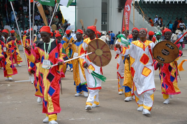
ABOUT TARABA STATE
Know All About Taraba State
SINCE 1991
Taraba State at a Glance
Taraba State was created on August 27th, 1991 when the Babangida Military Administration carved it out of the defunct Gongola State.
The State derives its name from one of the three major rivers and covers a land area of 59,400 square kilometres. At inception, the state comprised only ten Local Government Areas namely; Jalingo, Donga (created on 27th August 1991 Zing, Lau, Karim Lamido, Sardauna, Bali, Gashaka, Wukari and Takum.
The State currently has sixteen local government areas as a result of the creation of the following new LGAs; Ibi and Yorro in September 1991 and Ardo Kola, Kurmi, Ussa and Gassol in 1996.
There is also Yangtu, a Special Development area created by Danbaba administration in 2008 and NGADA Special Development Area which was created by Governor Darius Dickson Ishaku in September 2016.
The State derives its name from River Taraba and is made up of sixteen (16) Local Government Areas and two Special Development Areas.
These areas constitute administrative units in three geopolitical zones with a total population of about four (4) million people.
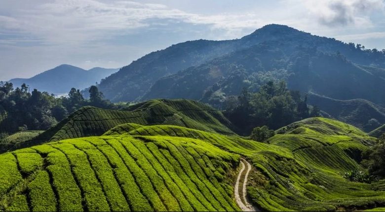
CLIMATE
The dry and rainy season common to tropical regions are also the dominant climatic features. The rainy season starts in April and ends in October, while the dry season begins in November and terminates in March.
The dry Season reaches its peak in January and February when the dusty north-east trade winds blow across the state.
The climatic, soil and hydrology of the State provide a conducive atmosphere for the cultivation of most staple food crops, grazing land for animals and fresh water for fishing as well as forestry.
LOCATION
Taraba State lies roughly between latitude 6030″ and 9036″ north and longitude 90 10″50″ east. It is bounded by Bauchi and Gombe and Adamawa States in the north-east, and by Plateau State in the north-central.
The state is further bounded to the north central by both Nasarawa and Benue States, while it shares an international boundary with the Republic of Cameroun to the south and south-east.
VEGETATION
The vegetation of Taraba State comprises three types of vegetational zones namely; the Guinea Savannah which is marked by mainly forest and tall grasses are found in the southern part of the State like Wukari, Ussa, Kurmi, Takum, and Donga.
The Sub-Sudan type characterized by short grasses is found in Jalingo, Lau, and Ardo kola, interspersed with short trees.
While the semi-temperate zone marked by luxuriant pasture and short trees is found on the Mambilla Plateau.
OUR MISSION
Lorem ipsum dolor sit amet, consectetur adipiscing elit, sed do eiusmod tempor incididunt ut labore et dolore magna aliqua. Ut enim ad minim veniam, quis nostrud exercitation ullamco laboris nisi ut aliquip ex ea commodo consequat. Duis aute irure dolor in reprehenderit in voluptate velit esse cillum dolore eu fugiat nulla pariatur.
OUR VISION
Lorem ipsum dolor sit amet, consectetur adipiscing elit, sed do eiusmod tempor incididunt ut labore et dolore magna aliqua. Ut enim ad minim veniam, quis nostrud exercitation ullamco laboris nisi ut aliquip ex ea commodo consequat. Duis aute irure dolor in reprehenderit in voluptate velit esse cillum dolore eu fugiat nulla pariatur.
OUR PURPOSE
Lorem ipsum dolor sit amet, consectetur adipiscing elit, sed do eiusmod tempor incididunt ut labore et dolore magna aliqua. Ut enim ad minim veniam, quis nostrud exercitation ullamco laboris nisi ut aliquip ex ea commodo consequat. Duis aute irure dolor in reprehenderit in voluptate velit esse cillum dolore eu fugiat nulla pariatur.
EXPLORE TARABA STATE